Geo Positioning
Overview
The geo positioning view allows you to observe the QGeoPositionInfo data supplied by a QGeoPositionInfoSource to your application, in textual form as well as on a map view. It is also possible to override that positioning information manually or via a pre-recorded NMEA file, enabling you to easily test location-aware application.

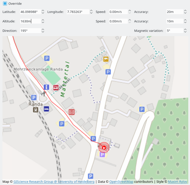
By default the input widgets at the top of the view show the current positioning information provided by QtPositioning. The map view at the bottom highlights the current position with a blue marker, and the movement history with a blue line. You can center the map on the current position using the corresponding menu action or the keyboard shortcut F3.
Manual Override
You can switch the geo positioning view into override mode using the checkbox at the top left. This will enabling editing on all input widget on the top, and show a second position marker and movement track on the map, in red. For the application the positing information are replaced with what you enter here now, independent of what the QtPositioning backend reports.
Besides changing individual values of QGeoPositionInfo in the widgets at the top, you can also set a position on the map view directly:
- Left-click will change latitude and longitude.
- Ctrl + mouse wheel will change the direction.
Note that the override mode is only available when the target application has been started with GammaRay, not when attaching to it at runtime. Observing the data is possible in both cases.
NMEA Replay
Besides manual override it is also possible to replay a recorded NMEA track from a satellite positioning source. For using this switch the to manual override mode and select Positioning > Load NMEA file... from the menu.